Places of the Project
The de Leon brothers describe a number of places in Austin. Some of these places, though changed, still exist today, while others have disappeared. Below are a few photos and maps which provide imagery and context for the places discussed in the interviews.
The Palm School
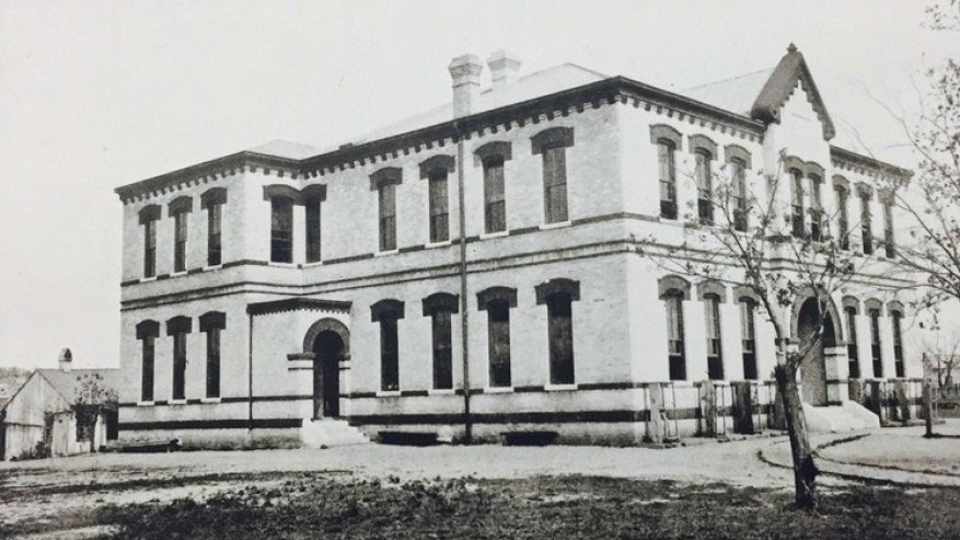
Palm School. Located on West Cesar Chavez Street and I-35, originally 1st Street and Highway 81/East Avenue. It was built in 1839 and became a school in 1892. Originally a white school, it became almost completely Mexican American by the 1960s due to white flight. The building is still standing today. Photo Courtesy of Waterloo Greenway and Austin American-Satesman.
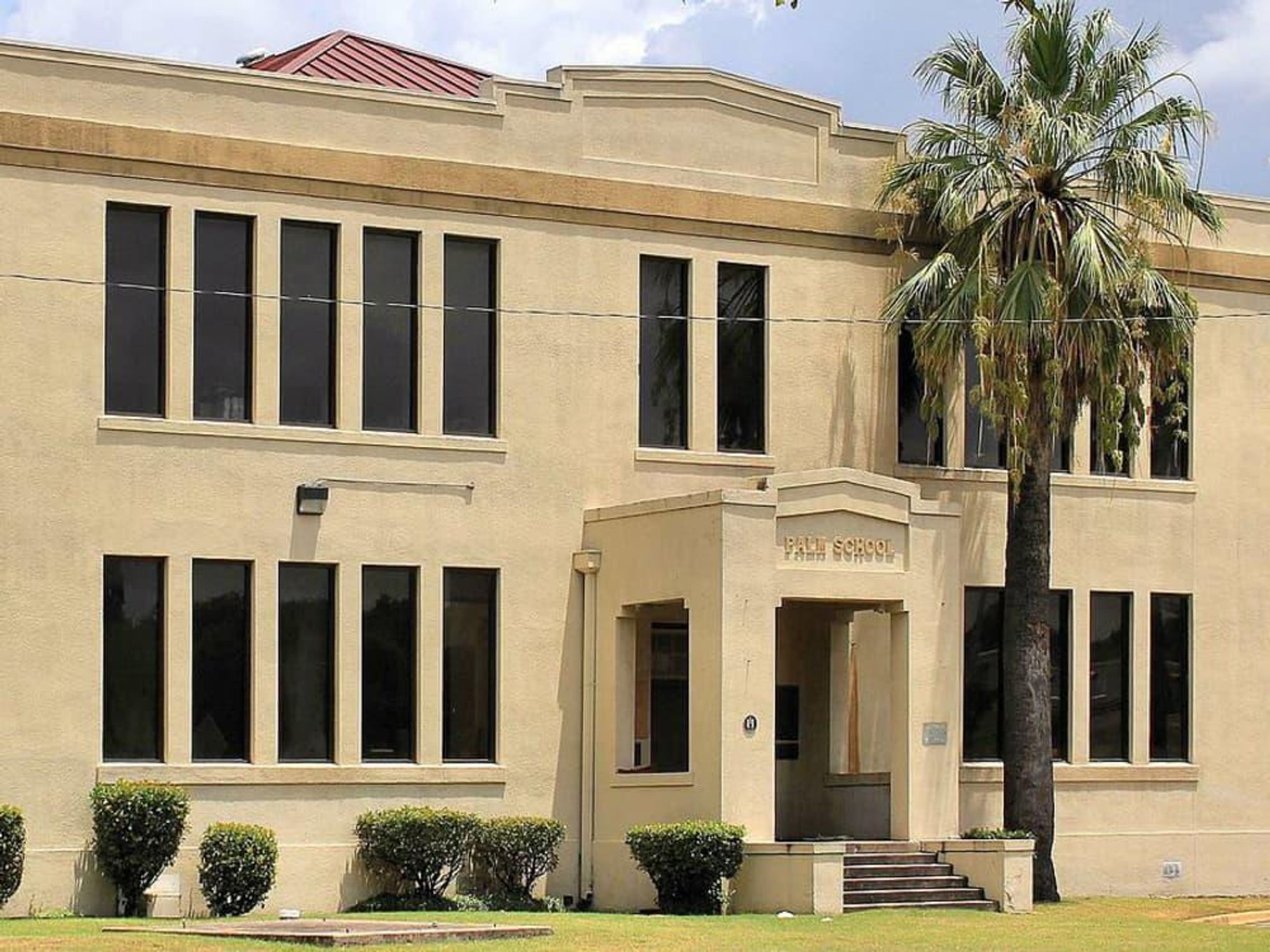
Photo Courtesy of Culture Map Austin and the Wikimedia Commons.
East Austin Neighborhood
East Austin is an area of Austin, originally east of Congress Avenue and now East of I-35. It was populated mostly by black and hispanic residents at the time the de Leons lived there, and continues to have higher populations of black and hispanic residents than the rest of Austin today. This is the legacy of Austin City Council’s 1928 plan, which was a housing plan to intentionally segregate all black residents (and eventually Mexican American residents) to the area east of East Avenue, the future I-35. The discriminatory housing practices which created this segregation can be seen in this map of Austin from 1934, which depicts “Redlining” a practice banks and realtors engaged in by assigning value to certain neighborhoods based on their racial makeup. In the map, East Austin is marked mostly as “Definitely Declining” or “Hazardous.”
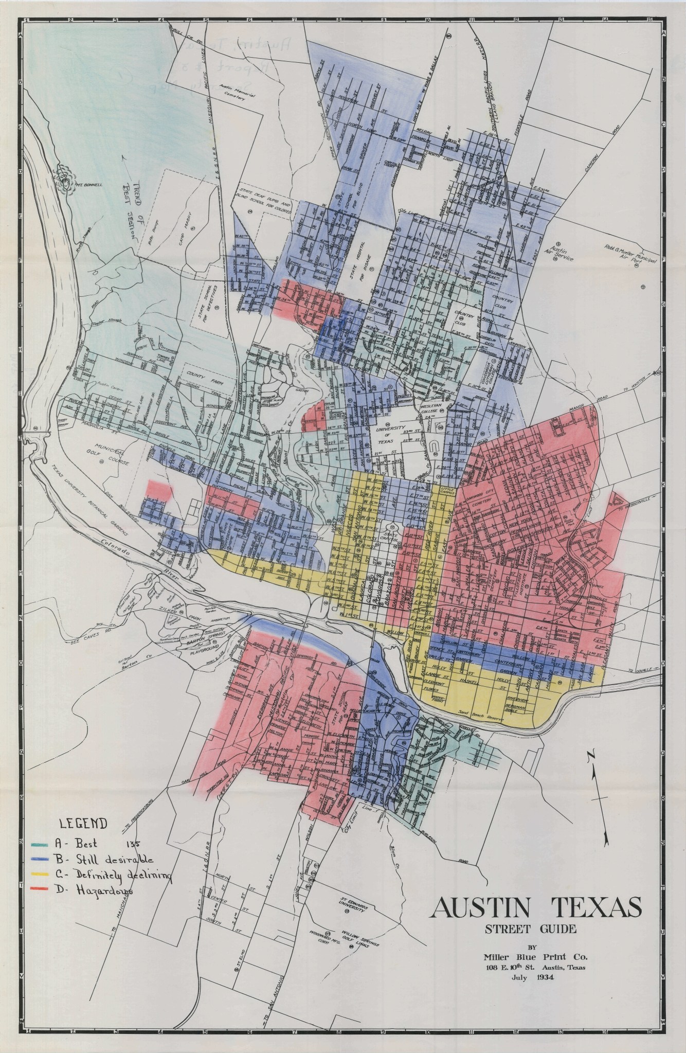
Photo courtesy of the Mapping Inequality: Redlining in New Deal America Digital History Project from Eliot Tretter and Andrew Busch, “Mapping Inequality, Austin, Texas.”

Marcos and Gerardo de Leon with their father, Francisco “Frank” de Leon, circa 1965 in front of their home on 66 Rainey Street in East Austin. Photo courtesy of the Palm School Oral History Project, 2024, Travis County Archives in Austin, Texas. Frank de Leon, Jr. Photo 01.
Palm Park
Palm Park was located directly behind Palm School. It is currently under construction, but is expected to reopen to the community sometime within the coming years. It was a place where the local Mexican American community could gather and host events. The park still exists today, though it is currently under construction as of 2026 and is expected to reopen to the public in the future.
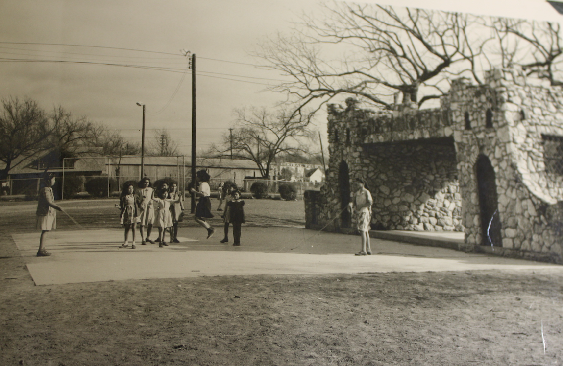
Photo Courtesy of Waterloo Greenway and the Austin History Center, Austin Public Library.
I-35
Interstate 35, or I-35, cut right through the Mexican American community in East Austin. Originally East Avenue/Highway 81, it served as the dividing line between the primarily “white” side of Austin in the west and the “Black” and “Hispanic” side of Austin in the east. It was originally significantly easier to cross on foot, and elementary school students from East Austin would traverse it to come to Palm. When it was turned into I-35, it became difficult, and when the interstate was expanded, it became impossible. Construction on I-35 was authorized in 1956 with the Federal Highway Act, and was later completed in 1962. It was expanded in 1973 and ’74 to include the upper decks.
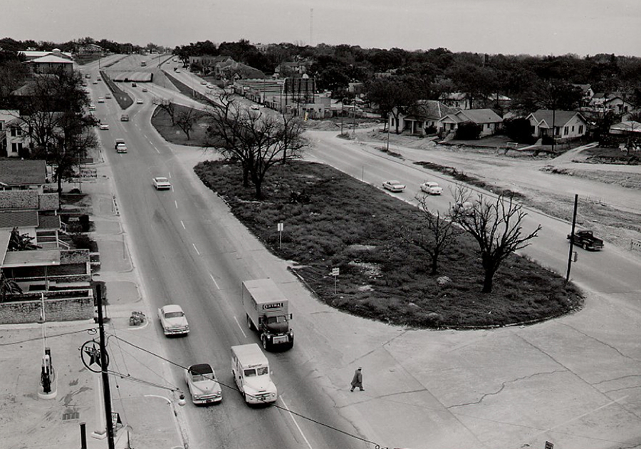
The original East Avenue (the future I-35) circa 1958, when the De Leons were attending Palm. Though still dangerous, it was still possible to cross on foot. Photo taken near Martin Luther King Boulevard looking South. Photo courtesy of the Texas Department of Transportation website MyMobility35 “History of I-35” page.
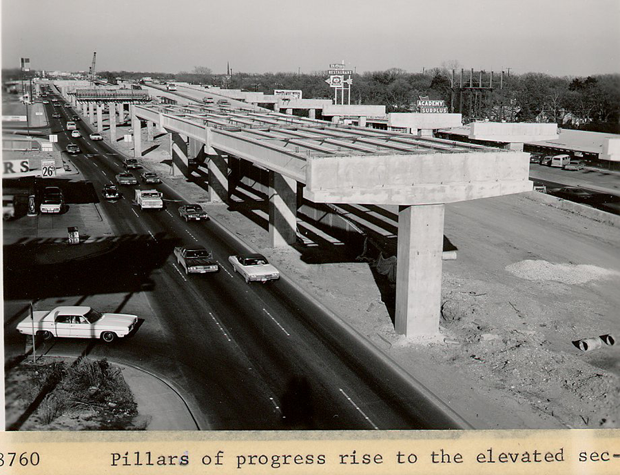
Photo shows the construction of the upper decks of the I-35 expansion circa 1973-74. Taken roughly from 6th Street and facing north. Palm school is located on 1st Street, just five streets farther south. Photo courtesy of the Texas Department of Transportation website MyMobility35 “History of I-35” page.
Salvation Army Youth Center
The Salvation Army Youth Center was a center present in east Austin which served the homeless population as well as providing community services such as a a place to host sports teams and family movie nights for the local population, including families like the de Leons.
The Salvation Army building located on 107 East 2nd Street, circa 1979. Photo courtesy of the Portal to Texas History, taken by Craig Kennedy in August 1979. https://texashistory.unt.edu/ark:/67531/metapth672569/